HAMILTON – There are some prescribed burning projects planned on the Bitterroot National Forest.
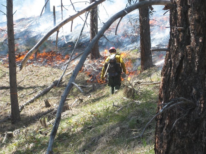
The burns planned will consist of pile burning to reduce residual slash from thinning and timber harvest operations and prescribed burns to reduce forest fuels and restore characteristics of a fire-adapted ecosystem, according to Bitterroot National Forest spokesman Tod McKay.
Fire managers plan to burn approximately 2,200 acres this fall. Smoke from the burns will likely be visible from West Fork Highway, East Fork Road, and US Highway 93 South.
The Ravalli County Sheriff’s Office advised that the Stevensville Ranger District will be doing a controlled burn on Tuesday in the Ambrose Saddle area on Tuesday and smoke will be visible in the area.
McKay notes in a news release that the burns will only take place if operational safety, fuel moisture, weather conditions, and air quality parameters can be attained. All areas will also be signed and notifications will be made to local residents. Fire managers plan to conduct the burning quickly.
The fire danger remains “High” on the Bitterroot National Forest and the vegetation in the valley is dry, especially the cured grass from this summer’s growth. Fires can grow rapidly, even in low winds in cured grasses.
While campfires are allowed, everyone should be sure all campfires and warming fires are cold to the touch before leaving them unattended.
Darby/Sula Ranger District – 1,000 acres are planned:
- Tepee Face Ecoburn, near Tepee Lookout (prescribed burn)
- Nee Mee Poo, along Highway 93 south of Sula (pile burning)
- Como/Horse Lick, south of Lost Horse and north of Lake Como (prescribed burn)
- Downing Mountain Lodge & Observation Landings (pile burning)
- Trapper Bunkhouse, SW of Darby between Little Tin Cup & McCoy Creeks (prescribed burn)
West Fork Ranger District – 1,000 acres are planned:
- Lower West Fork Units north of Boulder Creek and south of Baker Lake Road
(prescribed burn) - Upper Nez Units near Watchtower Trailhead and Flat Creeks (pile burning)
- School Point Ecoburn, east of Nelson Creek and east of Halford Creek (prescribed burn)
- Lower West Fork Units near Troy and Pierce Creeks (pile burning)
- Piquett Ridge and One Creek (pile burning)
- Applebury Boat Launch (pile burning)
Stevensville Ranger District – 200 acres are planned:
- Three Saddle Units, east of Stevensville on Ambrose Road #428 in the Sapphire Mountains (prescribed burn)
Forest officials note low intensity prescribed fires have several objectives including:
- Maintain forest health and ecosystem restoration
- Improve wildlife habitat – many plants respond favorably to fire providing new food sprouts for wildlife.
- Reduce the potential of large, high intensity wildfires by reducing the amount of downed fuel to burn.
- Post-harvest slash treatment – reduce residual slash created by thinning operations and personal use firewood cutting.
