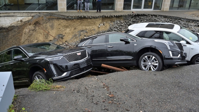
Areas of Massachusetts and Rhode Island got 10 inches of rain within 6 hours on Tuesday, causing heavy flooding and prompting emergency declarations, boat rescues and evacuations in the face of aging dam infrastructure.
Schools closed and shelters opened in Leominster, north of Boston. Mayor Dean Mazzarella said most of the buildings in the downtown area had flooded, and some had collapsed.
Some 300 people were evacuated, including some living near one of the city's nearby earthen dams, which is listed in poor condition and due for replacement.
The city experiences periodic flooding, according to planning documents. The North Nashua River notched significant high flow events in 1936, 1938 and 1955.
"During these floods, streets were inundated, dams were overtopped and bridges collapsed," according to a planning document.
Additional rain is expected in the area on Wednesday, and portions of the state could experience flooding as Hurricane Lee gets closer over the weekend.
SEE MORE: 'We feel forgotten': Vermont flood victims navigate lengthy recovery
Officials said the rainfall was a 200-year event, meaning that in any given year, there is a 1 in 200 chance of that much rain falling in a single event.
Climate change is expected to drive more frequent and more intense rainfall events. Experts said the signature was already present in this week's flooding, where the moisture in hot, humid air contributed to the rainfall.
"As long as fossil fuel emissions continue, this will get worse," said Mathew Barlow, a climate scientist at the University of Massachusetts-Lowell. "So this won’t be a new normal. This will be a way station on the way to ever more intense systems unless we choose to dramatically decrease emissions."
Trending stories at Scrippsnews.com


