

HAMILTON — The Bitterroot National Forest is providing an update on the Johnson Fire and the Sharrott Creek Fire burning in Ravalli County.
Johnson Fire
The Johnson Fire which is three miles south of Springer Memorial Community has been mapped at 8,337 acres as of Wednesday.
Fire managers report most of the fire activity is north of the 5771 Road and in the Lick Creek area.
The blaze is burning within a containment area and is moving away from the Springer Memorial Community.
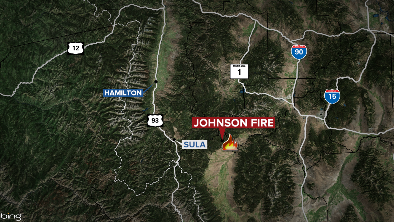
The fire is still smoldering and creeping in the Swift and Dense Creek areas. Multiple helicopters have been dropping water in the areas.
There are 45 personnel assigned to the Johnson Fire.
Trail and road closure information can be found here.
Sharrott Creek Fire
The 3,200-acre Sharroott Creek Fire has seen little growth as it burns three miles west of Stevensville.
The wildfire is being managed by Type 4 Incident Team from the Bitterroot National Forest Stevensville Ranger District.
The fire is burning to the southwest corner.
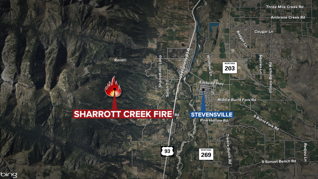
A total of 10 firefighters are working the Sharrott Creek Fire which was sparked by lightning on August 23, 2024.
The Bitterroot National Forest provided the following information in the October 16, 2024 update:
Oct. 16 Weather Update: Source DEQ Montana
A cool front marches across the Treasure State today, scouring out much of the smoke trapped in the valleys of Southwest Montana. It will also produce some beneficial rain and mountain snow for much of the state.
Today is the transition day to more typical mid-October weather as a cool front moves across the state. The front will be accompanied by some much-needed precipitation. For much of the area, it’s been nearly 3 weeks without measurable precipitation. The lack of precipitation and unseasonably warm air has allowed numerous regional wildfires to experience tremendous growth. The front and corresponding area of low pressure will bring snow levels down to 4,000 feet and the passes could receive a few slushy inches of snow. Expect smoke production on area wildfires to decrease significantly behind the system.
Precipitation will linger Oct. 17, with the greatest rain and snow totals focused on the higher terrain of Northwest Montana and along the spine of the Bitterroot Mountains. Temperatures will plummet on Oct. 17 as highs will hover in the 40s and low 50s.
The system departs early Friday as the precipitation gradually comes to an end. The precipitation should help moderate fire activity across Idaho and Montana, greatly reducing surface smoke concentrations. A transient ridge of high pressure develops over the weekend. It will provide slightly warmer temperatures and abundant sunshine.
