

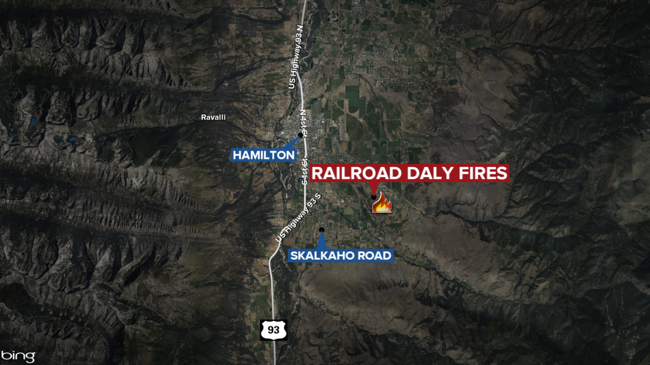
HAMILTON — The Railroad-Daly Fire burning 26 miles southeast of Hamilton has grown to a combined 12,817 acres.
The Wednesday update shows the Daly Fire is at 11,234 acres while the Railroad Fire Acres has burned 1,583 acres.
Fire managers report minimal fire behavior was seen on Tuesday with internal heavy fuels burning and isolated tree torching. The update states during the night hours, the fire backed down closer to Skalkaho Highway. Fire crews will remain in place along Skalkaho Highway to monitor fire activity during the night hours.
The evacuation warning issued by the Ravalli County Sheriff's Office on October 9 for residents in the 1700 to 2500 block of Skalkaho Highway remains in effect.
Additional evacuation information can be found on the Ravalli County Sheriff's Office Facebook page. Residents can register
for emergency notifications at http://hyper-reach.com/mtravallisignup.html.
More information from the October 16, 2024, update:
WEATHER AND FIRE BEHAVIOR
Today will be the last of the warm and dry days this week. Elevated fire weather concerns are still anticipated for Wednesday afternoon as gusty winds increase, and low relative humidity remains. There is a decent chance of wetting rains on the terrain Wednesday night as a cold front passes through. Cool and wet conditions will continue into Thursday. Thursday night will bring snow to 4,000 feet in the Bitterroot.
EVACUATIONS
On October 9, 2024 the Ravalli County Sheriff’s Office issued an Evacuation Warning for residents off of Skalkaho Highway (1700-2500 block) due to the Railroad-Daly Fire. For more information on evacuations visit the Ravalli County Sheriff Facebook page.
To register your phone number for emergency notifications in Ravalli County visit, http://hyper-reach.com/mtravallisignup.html.
CLOSURES
The Beaverhead-Deerlodge National Forest has issued an Area/Road/Trail Closure effective October 4, 2024.
The Bitterroot National Forest has also issued a road closure effective October 10, 2024.
These orders are for public and firefighter safety during fire suppression efforts on the Fire.
Closure information and maps are posted on the Bitterroot and Beaverhead-Deerlodge National Forests’ website www.fs.usda.gov/alerts/bdnf/alerts-notices and www.fs.usda.gov/alerts/bitterroot/alerts-notices.
A total of 265 people are assigned to the Railroad-Daly Fire.
