


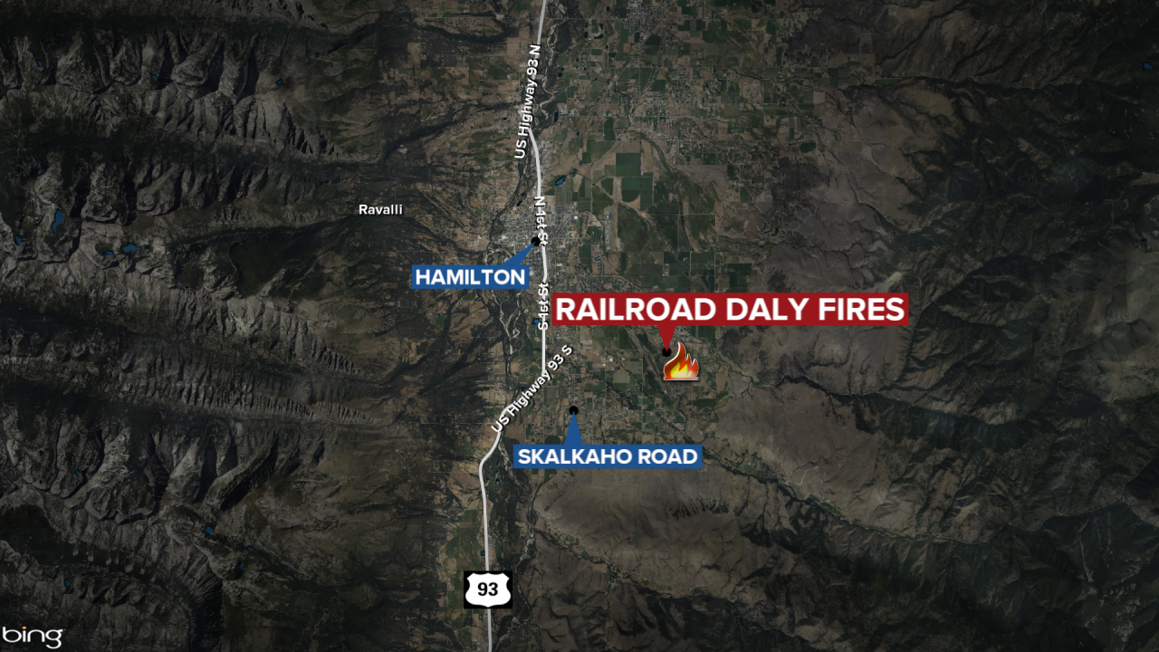
HAMILTON — The Railroad-Daly Fire burning 26 miles southeast of Hamilton has now burned a combined 9,677 acres.
The Wednesday update shows the Daly Fire is at 8,377 acres and is 56% contained while the Railroad Fire Acres has burned 1,300 acres and is 35% contained.
MTN News
Fire managers report that the fire was active and moved to the north in the Skalkaho Falls area towards Dam Lake. In Daly Creek, the fire continued progressing down drainage below Gird. Helicopters and air tankers were used to perform drops to help ground crews.
More information from the October 9, 2024, update:
"Crews will continue to establish a shaded fuel break along Coal Creek Road and will continue progressing to the Stony Creek area. Structure protection will be enhanced in Stony Creek and crews will closely monitor fire activity in the upper Stony Creek area. Crews will continue constructing and improving hand and dozer lines from Gird Creek Road to Highway 38. Aerial resources will remain actively engaged.
WEATHER AND FIRE BEHAVIOR
Near critical fire weather conditions are anticipated this afternoon. A warming trend is expected to continue today accompanied by low humidity and wind gusts of 25-35 mph.
Fire activity and potential will remain high in the near future due to current and forecasted weather. In the West, burn periods will be longer than usual, especially during wind events. Other areas are likely to see increased fire potential as leaf fall rises, with little precipitation expected. Anomalously dry conditions in the West will heighten fire activity in October, with significant fire behavior during wind events potentially resembling August's intensity, including long burn periods.
CLOSURES
All areas along State Highway 38 (Skalkaho Highway) beginning at the top of Skalkaho Pass from the east near mile marker 26.5 along State Hwy 38 and turning to the north at the junction of State Hwy 38 and Rock Creek Road. From State Highway 38 and Rock Creek Road (County Road 102) turning north to the junction of State Highway 348 and Rock Creek Road and proceeding northwesterly on Rock Creek Road (County Road 102) to the junction of USFS Road 241. Following USFS Road 241 (Stony Creek Road) moving southwesterly to the junction of Little Stony Creek and Stony Creek. Following Little Stony Creek west to the ridge where Trail 313 (Bitterroot Rock Creek Divide Trail) begins and continuing south along Trail 313 to the intersection and ending at mile marker 14 on west side of State Highway 38."
A total of 175 people are assigned to the Railroad-Daly Fire.
