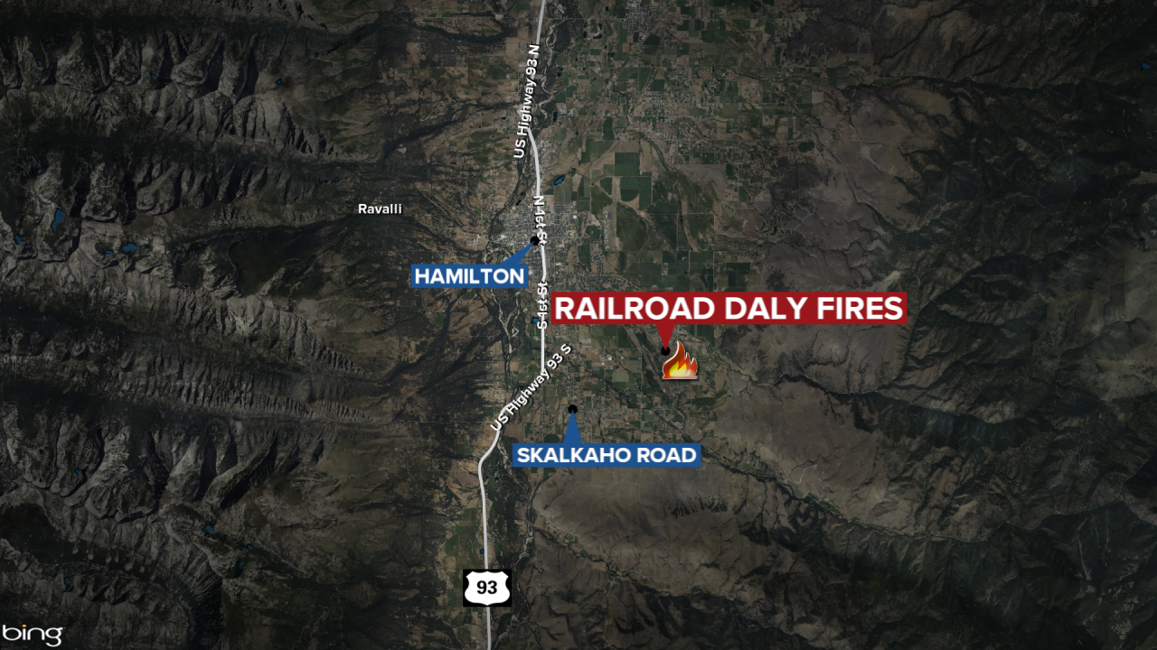

HAMILTON — The Railroad-Daly Fires southeast of Hamilton have burned over 2,600 acres and are 4% contained.
The Daly Fire has burned 2,170 acres while the Railroad Fire is at 490 acres, according to an update issued Monday.
A section of the Skalkaho Highway remains closed to traffic between Black Bear Campground and Skalkaho Pass. Gird Point Lookout is also closed.
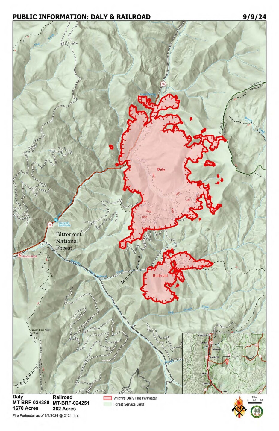
Fire managers report the Daly Fire is moving towards Skalkaho Pass with overnight winds pushing the blaze. The number of acres burned is expected to be updated when the next mapping flight happens.
Crews will continue to remove hazardous trees along the south side of Highway 38 to mitigate safety concerns when the highway reopens.
Northern Rockies Complex Incident Management Team 5 took over management of the fires at 6 a.m. on Monday.
There are 33 people assigned to the fires.
