


MISSOULA - Looking at another hot and dry day for Western Montana on Monday.
Highs will be in the upper 80s to low 90s with some smoky and hazy skies as well.
Tuesday will be hot again, however, big changes are on the way.
A cold front along with a storm system from the Pacific will begin to impact the Northern Rockies by Tuesday afternoon.
Thunderstorms will develop with some strong storms possible as well.
The biggest impacts will be gusty winds with gusts of 60 mph possible.
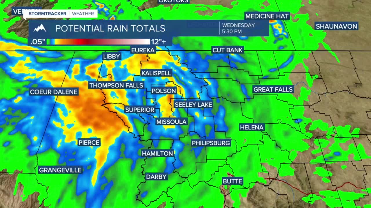
Widespread rain will develop Tuesday night into Wednesday with the heaviest rain falling across Northwest Montana.
The latest model runs have the potential for ½"-to-1" of rain in Northwest Montana, ¼"-to-½" in west-central Montana with lesser amounts in Southwest Montana.
Behind this front, a fall-like feel will develop Wednesday through Friday.
Highs will be in the 50s and 60s Wednesday, 60s and 70s Thursday then 70s and 80s Friday.
