


MISSOULA — Thanks to a series of low pressure systems - our week ahead looks wet and cool.
Mountain snow and valley drizzle will continue today off and on.
The Idaho Department of Transportation was reporting slush at Lost Trail Pass this morning, but most areas have limited impacts for the Monday morning commute.
An umbrella might be handy, but only a few moments of scattered moisture are expected for now.
Tomorrow, the precipitation starts to taper off and we get a nice midweek break Wednesday with some sunshine.
Then, the moisture returns Thursday (just in time for Halloween) and may continue into the weekend.
Temperatures like this will likely warrant layers under those Halloween costumes and possibly an umbrella to stay dry!
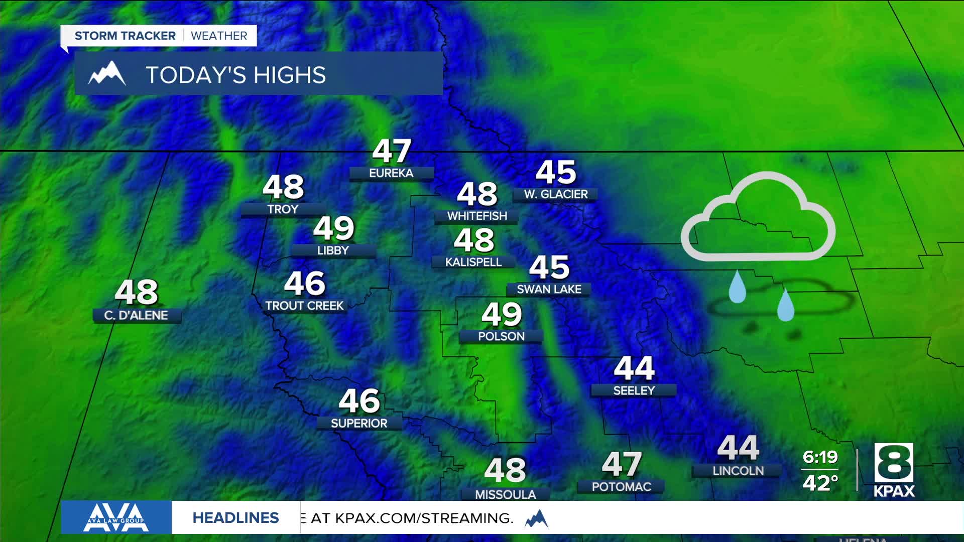
Throughout it all, temperatures will remain fairly steady in 40°s during the day and 20s and 30s overnight.
These temperatures will impact what types of precipitation we see though.
The low 40s usually means more of a rain and snow mix for valleys, while the upper 40s generally means more rain.
Overall, forecast models show an active end to October and an active start to November.
