MISSOULA — Maybe a bit warmer this afternoon, however, still very cold with highs in the single digits or below zero for this Martin Luther King Jr. Day.
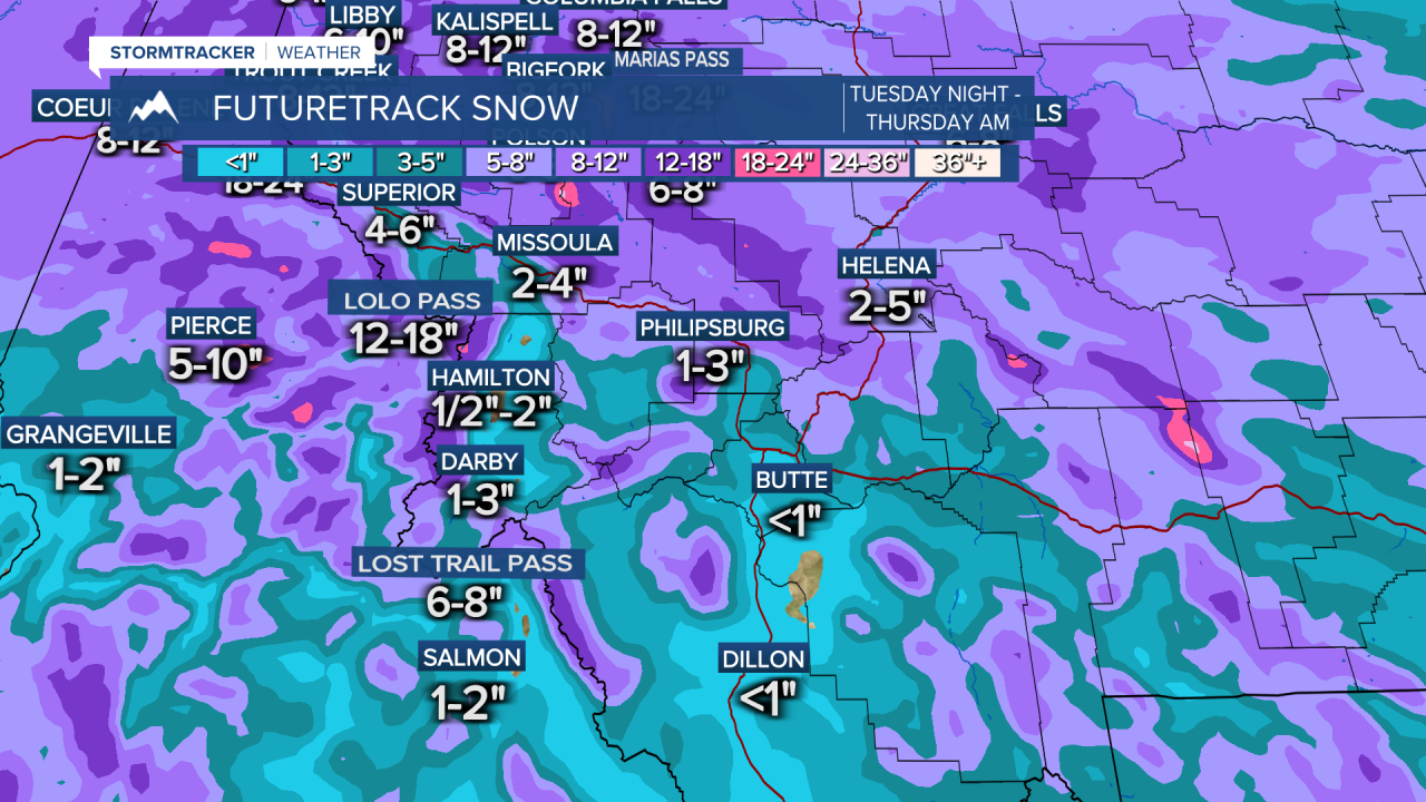
Our next winter storm moves in Tuesday night and continues through Thursday morning with heavy snow expected.
Main takeaway, this is shaping up to be a high impact event for NW Montana. From Polson and areas north, widespread snow amounts of 8"-to-12" is likely, with even more possible.
Warmer temperatures and some drier air will lead to the Bitterroot Valley seeing much less snow. Most likely around 1/2"-to-3" with higher amounts in the northern Bitterroot.
The I-90 corridor is setting up as the barrier between heavy and light snow. So this puts Missoula right on the border. Some models show as high as 10" in Missoula with others showing as low as 2". Right now, we'll go with 2"-to-4" in and around Missoula, however, this may need to be adjusted as more info comes in over the next 24 hours. Stay tuned for updates.
After this system moves out, we won't be done with the snow just yet. Models are showing a weak weather system continuing to bring light snow, especially to the mountains into the weekend.


