MISSOULA — We're not done with the winter weather just yet.
This morning, light snow showers have been falling. Later today, skies will be mostly cloudy once the snow showers finally taper off. Temperatures should warm up slightly today in a mix of 20s and low 30s.
Roads are still snowy, slushy, and slick across western Montana though. Continue to drive with caution!
Tonight we will see another round of snow start to move in. Overnight, areas south of the I-90 line are likely to see at least an inch. Then, more snow should fall through the morning on Friday.
Depending on the track of this system, Northwest Montana might miss out on this one. If the low pressure tracks further south, snow will mainly hit the Bitterroot and Granite counties again. If the low tracks further north, light snow could reach as far as Whitefish and Eureka.
Overall, this next round of snow will be much less than what we've already received this week. The highest model runs show the Bitterroot receiving 3" to 5" total from Thursday night until Friday night.
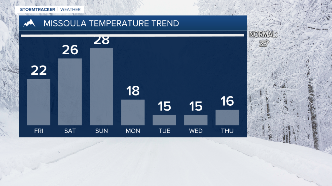
We get another break from the snow on Saturday, but then we get more arctic air early next week.


