MISSOULA — A few light snow showers or snow flurries will be possible Saturday with little to no snow accumulation expected.
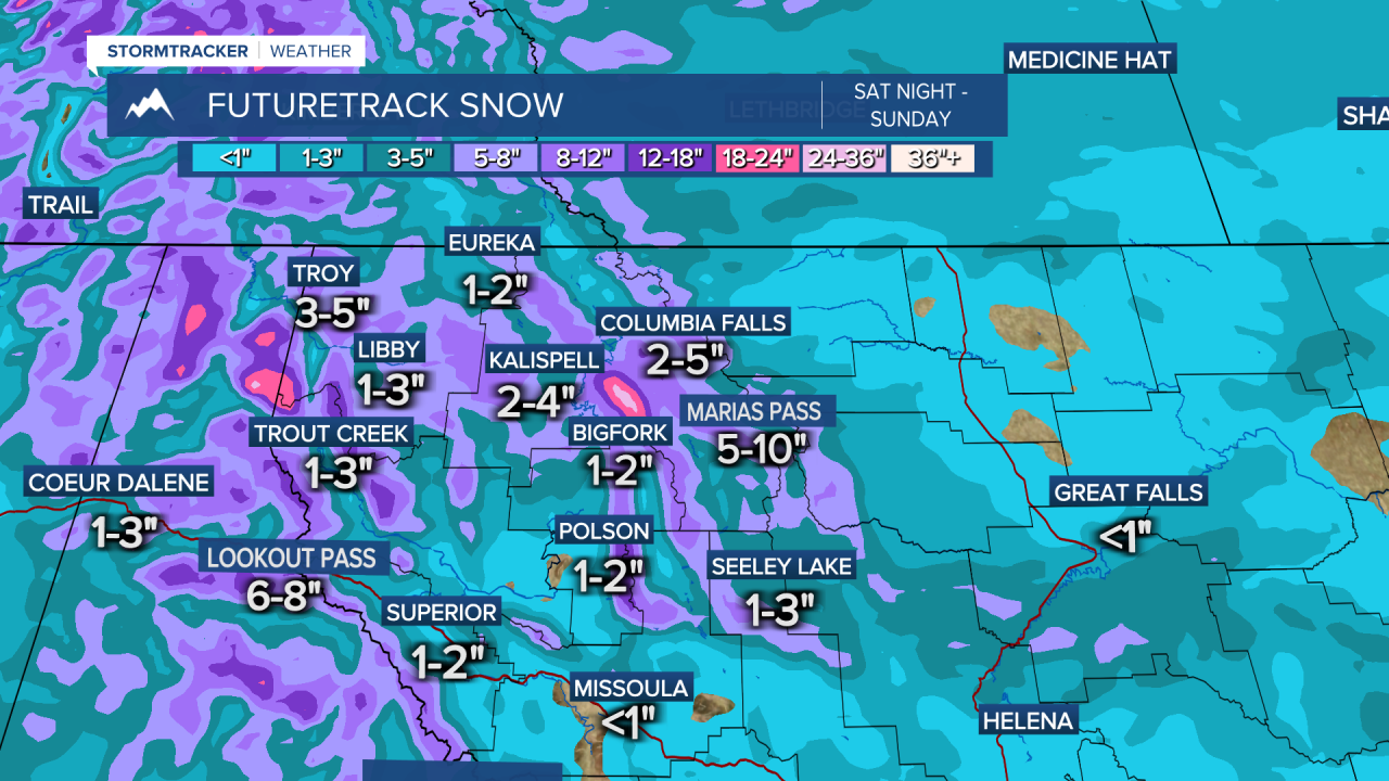
A stronger system will bring more widespread snow Saturday night into Sunday morning.
The heaviest snow will fall across northwest Montana with around 1"-to-4" in the valleys and 6"-to-10" over mountain passes. Expect only a trace to 1" at most for the Missoula and Bitterroot Valleys with 3" to 6" over Lolo and Lost Trail passes.
Active weather then continues next week with impacts from snow and cold becoming more extreme.
Tuesday into Wednesday models are showing a stronger system bringing the best chance for snow yet.
Now, it's still too far out to talk specific details but widespread accumulating snow will be possible during this time.
After this, models are showing the coldest air of the season moving in by Thursday of next week and continuing into the weekend.
If this comes together, highs will start out in the single digits and teens Thursday then drop into the single digits or below zero by Friday and Saturday!
Lows during this time are expected to drop to well below zero with wind chills even colder! Stay tuned for updates moving into next week.


